
easymap 12.3: Discover What’s New
With easymap 12.3, we’re introducing a range of enhancements designed to make your day-to-day work even more efficient. This release brings three major highlights: an integrated AI Chat, vector tiles as a new background map format, and a dedicated changelog in the easymap Support Portal. In addition, several further improvements have been introduced to streamline your mapping workflows.
See What’s New in easymap 12.3
AI Chat: Your Smart Assistant in easymap
If you use easymap regularly, you’ve probably experienced this before: you know what you want to do, but you can’t quite remember where to find the right function. Until now, help was available through the Support Portal, our service hotline or by contacting the support team via email. With easymap 12.3, there’s now another option – built directly into the application.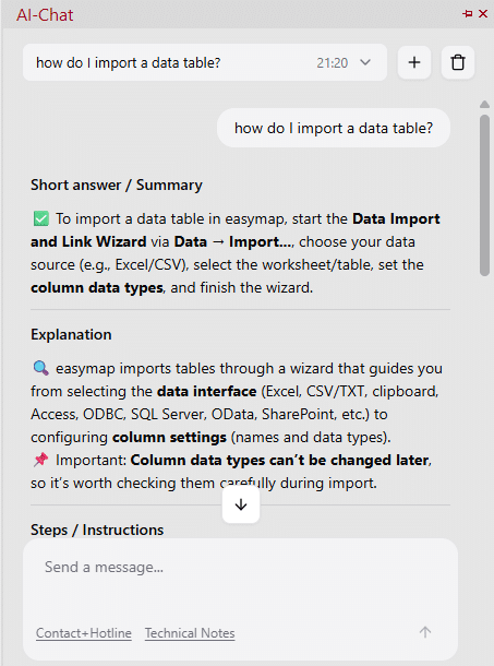
The integrated AI Chat helps you with questions about features, workflows and technical terminology without interrupting your work. It draws its answers primarily from the easymap Support Portal, official news articles and video tutorials, providing reliable information exactly when you need it. Each response also includes links to the original sources, allowing you to explore a topic in more detail whenever required.AI Chat in easymap 12.3 answering a user question about map data and analysis.
The AI Chat can be opened from the welcome screen, the main menu or the toolbar. If you use it frequently, easymap can even be configured to launch with the chat window already open.
Chat histories are automatically saved and can be reopened, copied, exported or deleted at any time. If you rate an answer using the integrated feedback buttons, the corresponding chat history is transmitted to easymap. This feedback enables us to continuously improve the quality of future responses.
The AI Chat is available exclusively to easymap Professional customers and can be disabled at any time in the global settings if required.
Vector Tiles in easymap 12.3: Background Maps That Adapt to Your Needs
Until now, background maps in easymap were primarily based on raster maps. As these are delivered as pre-rendered images, their appearance cannot be customised.
Vector tiles work differently. Instead of transferring a finished raster image, geographical information is provided as vector data. This allows colours, styles and map elements to be adjusted directly within easymap. Whether you want to highlight specific road types, simplify the map or hide individual layers, you now have complete control over how your background map looks.
The result is a background map that supports your analysis instead of forcing you to work with a single predefined style. Vector tiles are currently available for the DACH region as well as a worldwide map.
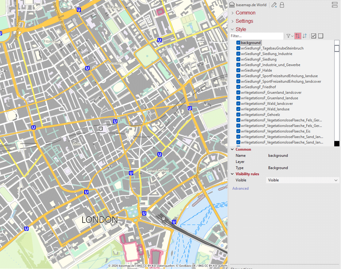
Figure: Vector tiles in easymap 12.3. Click the image to view it in full size.
Changelog Now Available in the Support Portal
With easymap 12.3, the Support Portal now includes a dedicated changelog. Starting with the first service pack, every change to a release will be documented and published on an ongoing basis.
The changelog provides a central overview of new features, enhancements, optimisations and resolved issues. This makes it easy to see exactly what has changed with each service pack and quickly identify updates that are relevant to your work.
This is particularly valuable for organisations using easymap across multiple teams or locations. Administrators and project managers can review changes at a glance, share relevant information internally and easily refer colleagues to specific updates. The changelog complements the detailed articles in the Support Portal and provides even greater transparency into the ongoing development of easymap.
More New Features in easymap 12.3
Alongside the AI Chat, vector tiles and the new changelog, easymap 12.3 introduces several additional enhancements that make working with maps, territories and route planning even more efficient.
Route Planning Add-on
The Route Planning add-on enables detailed route and workload calculations based on travel times, visit durations and distances within individual territories. Features include planning frameworks of up to 52 weeks, customised visit schedules, overnight tours and territory optimisation based on workload.
Travel Time and Distance Without Credit Consumption
Travel time and distance calculations for territory optimisation and district analysis are now available in easymap Professional without consuming credits.
Redesigned Base Map Management
The Base Maps window has been reorganised by country, category and data version, making it much easier to navigate when working with multiple countries or different administrative levels.
Isochrones in easymap Explorer
Accessibility analyses can now be uploaded directly to easymap Explorer and shared with colleagues.
Additional enhancements – including filter-based queries, GeoPackage support, automated map exports via the command line, and direct integration with Microsoft OneDrive and SharePoint – are documented in the complete changelog available in the easymap Support Portal.
Available Now
easymap 12.3 is now available for download. The update is available for all existing licenses.
More than just a download: A direct line to our experts:
This post is also available in: DE


 @infas360